Hello - and thank you for helping me!
I’m a new user, and learning Pix4D with a trial license. I hope to buy the license.
I’ve had good luck with Pix4D-Mapper making photomosaics and 3-D meshes using my drones capturing up to 750 images over 40 acres. I’m very pleased.
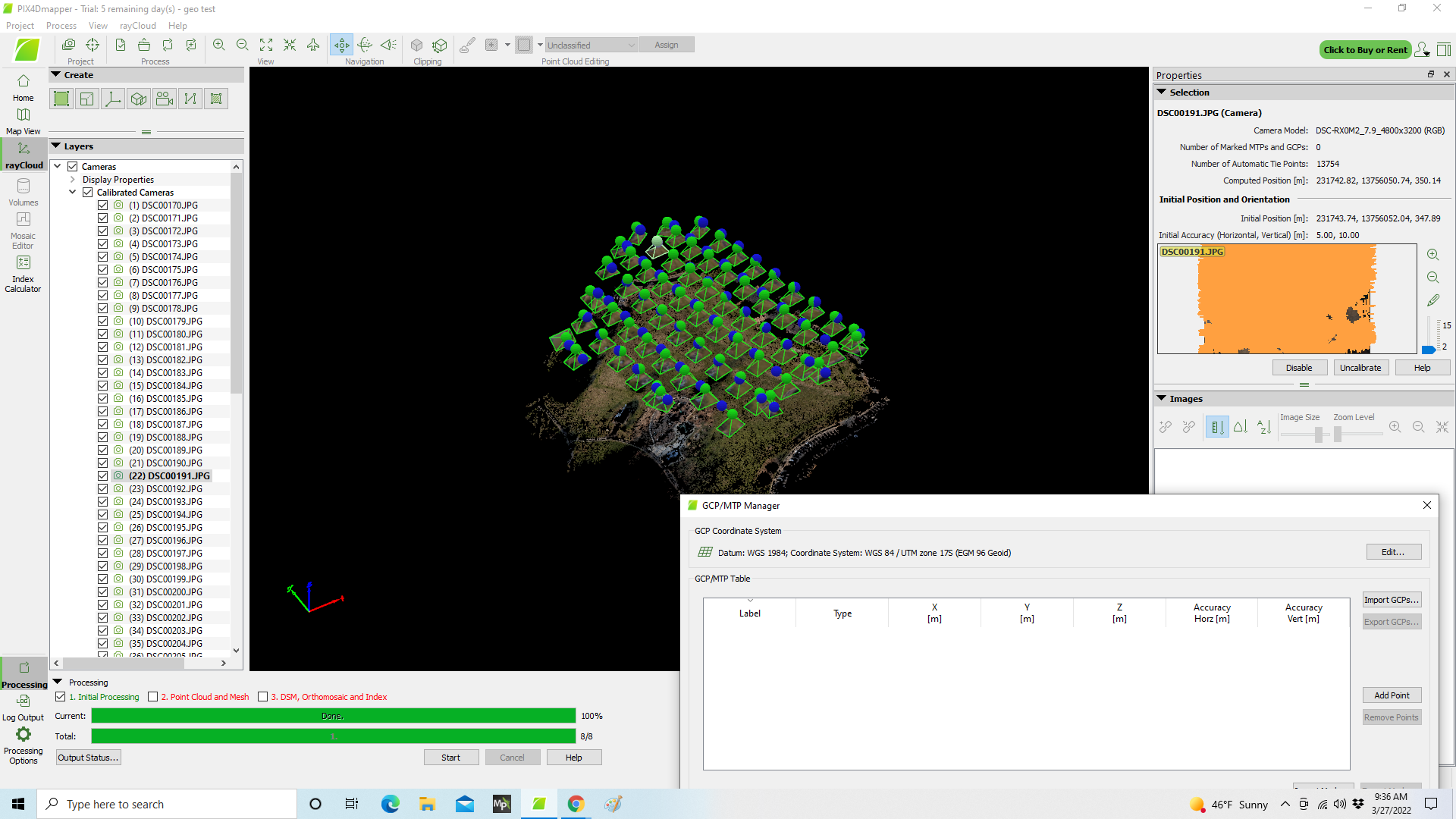
I started to learn how to include GCP’s, and I’ve run into a problem.
When I include my first GCP and re-run Step-1, all the cameras disappear from view.
I thought perhaps I had a problem with a mismatch of coordinate systems.
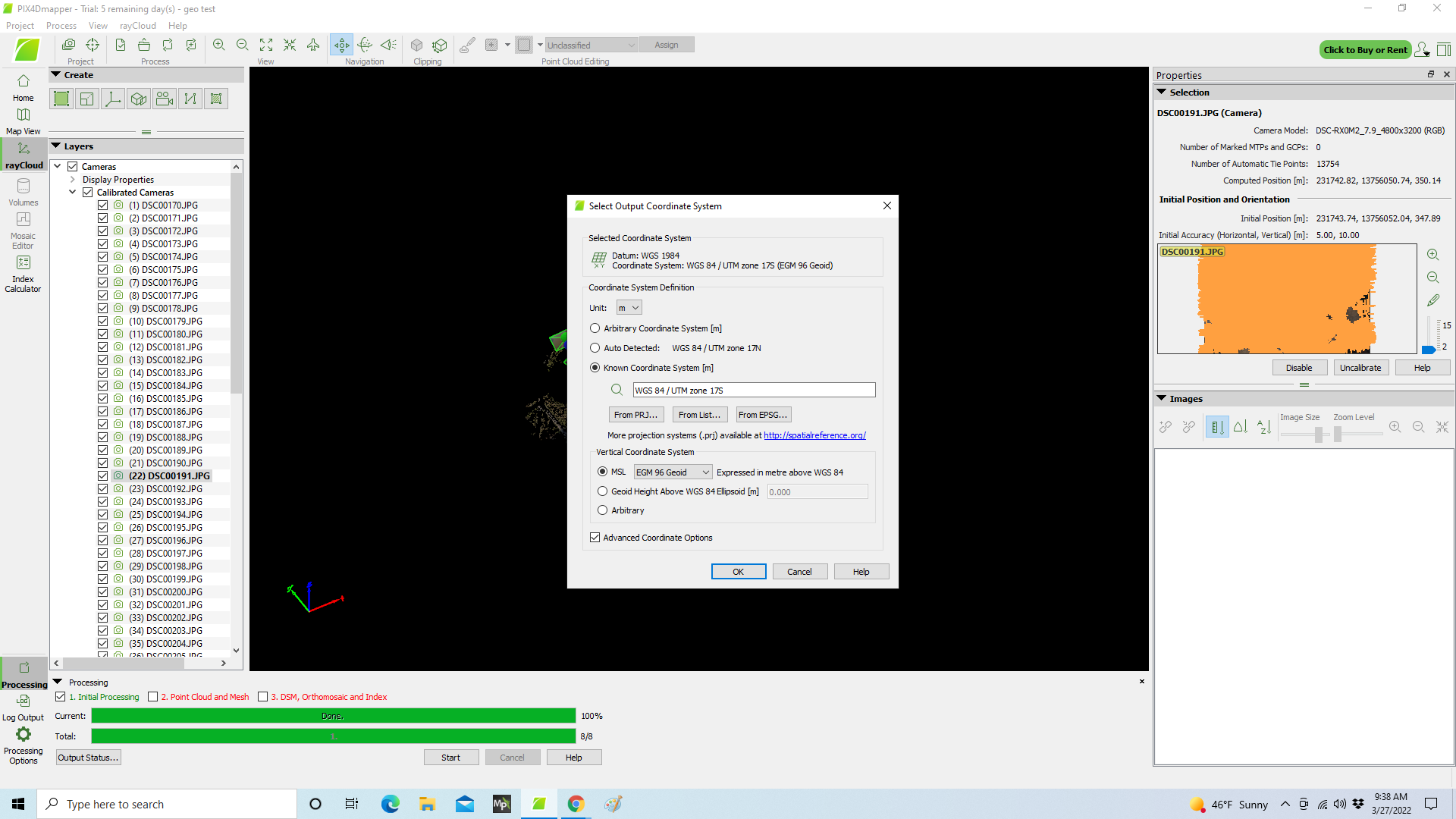
I discovered that Pix4D auto-detected the UTM Zone “17N” for my photos. My project is in UTM Zone “17S”. I started from the beginning again, and set the output coordinate system to UTM Zone “17S” - and re-created the project - and ran Step-1 again. Then I added a GCP, and set it’s coordinates to UTM Zone “17S” as well.
Then - re-running Step-1, all the cameras disappear from the view.
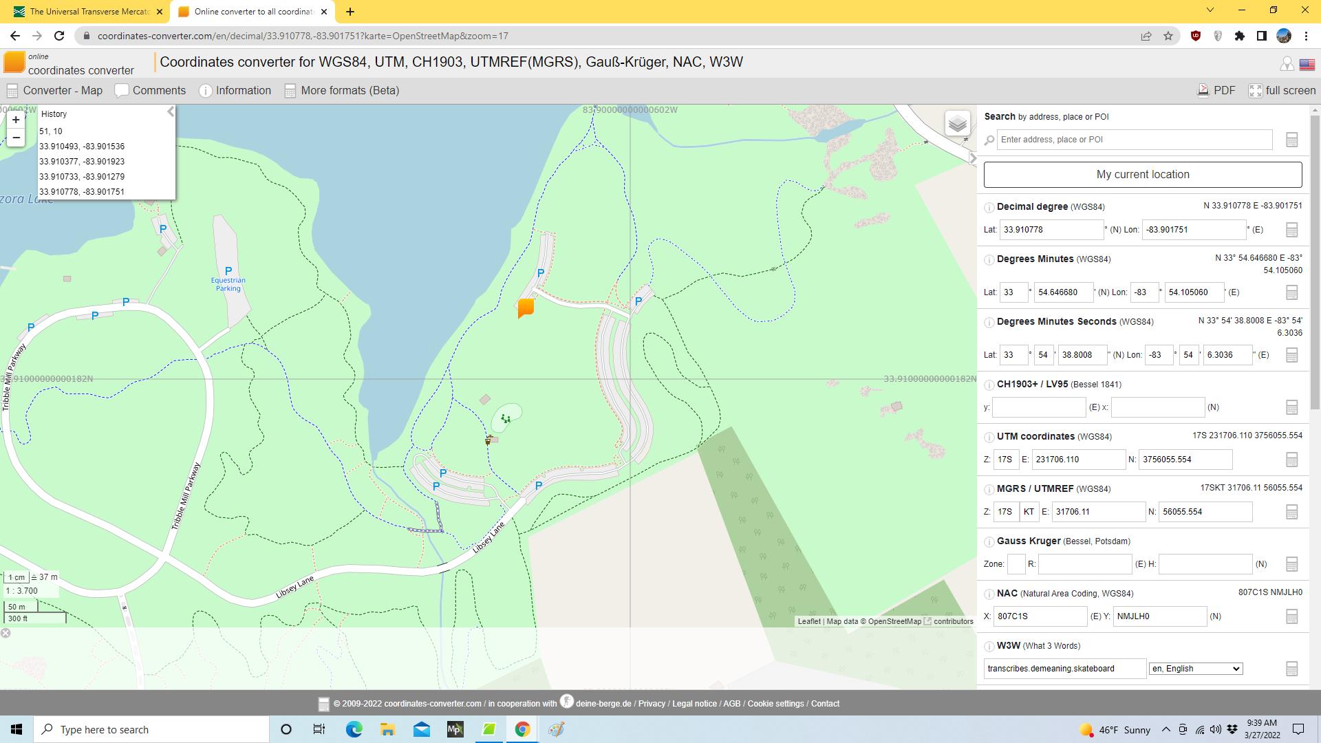
I’ve included screen-shots that may help explain. I’ve also included a screen shot of a map that shows that my subject location is in-fact in UTM Zone 17S.
Please let me know if I can provide more information.
Thank you for helping me!