I am having issues with the horizontal and vertical reference systems along with the Geoid #. The project I have been shooting has been in Monroe county Georgia. In the past I have been using:
Horizontal = WGS 84 - EPSG: 4326
Vertical = EGM 96 - EPSG: 5773
Geoid = 96
However, these are not the specific CRS for my location, which is strange because is always puts my GCPs right at the site I mapped.
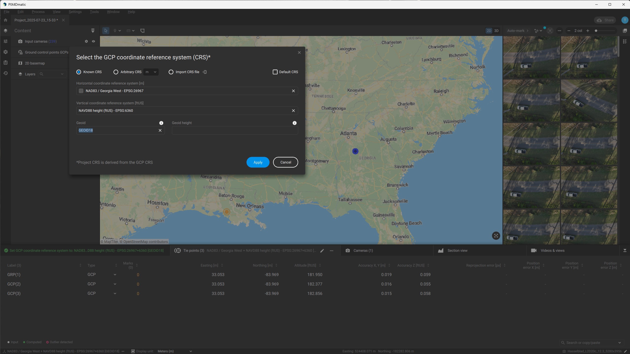
When I enter what Pix4DMatic says is correct for my area:
Horizontal = NAD83/Georgia West - EPSG: 26967
Vertical = NAVD88 Height (ftUS) - EPSG: 6360
Geoid = 18
It places my GCPs all the way at the coast in Louisiana.
When looking at your Tie points table (your second screenshot), the coordinates appear to be in longitude/latitude which is consistent with WGS84. What you need to do is change the GCP coordinate system to WGS84. If you keep in stateplane (NAD83/Georgia West) then it will put the GCPs in the wrong place.
These cookies are necessary for the website to function and cannot be switched off in our systems.
They are usually only set in response to actions made by you which amount to a request for services, such as setting your privacy preferences,
logging in, or filling in forms. These cookies do not store any personally identifiable information.
These cookies allow us to count visits and traffic sources so we can measure and improve the performance of our site.
They help us to know which pages are the most and least popular and see how visitors move around the site.
All information these cookies collect is aggregated and therefore anonymous.
If you do not allow these cookies we will not know when you have visited our site, and will not be able to monitor its performance.
These cookies may be set through our site by our advertising partner (Google).
They may be used by Google to build a profile of your interests and show you relevant adverts on other sites.
They do not directly store personal information but are based on uniquely identifying your browser and internet device.
If you do not allow these cookies, you will experience less targeted advertising.