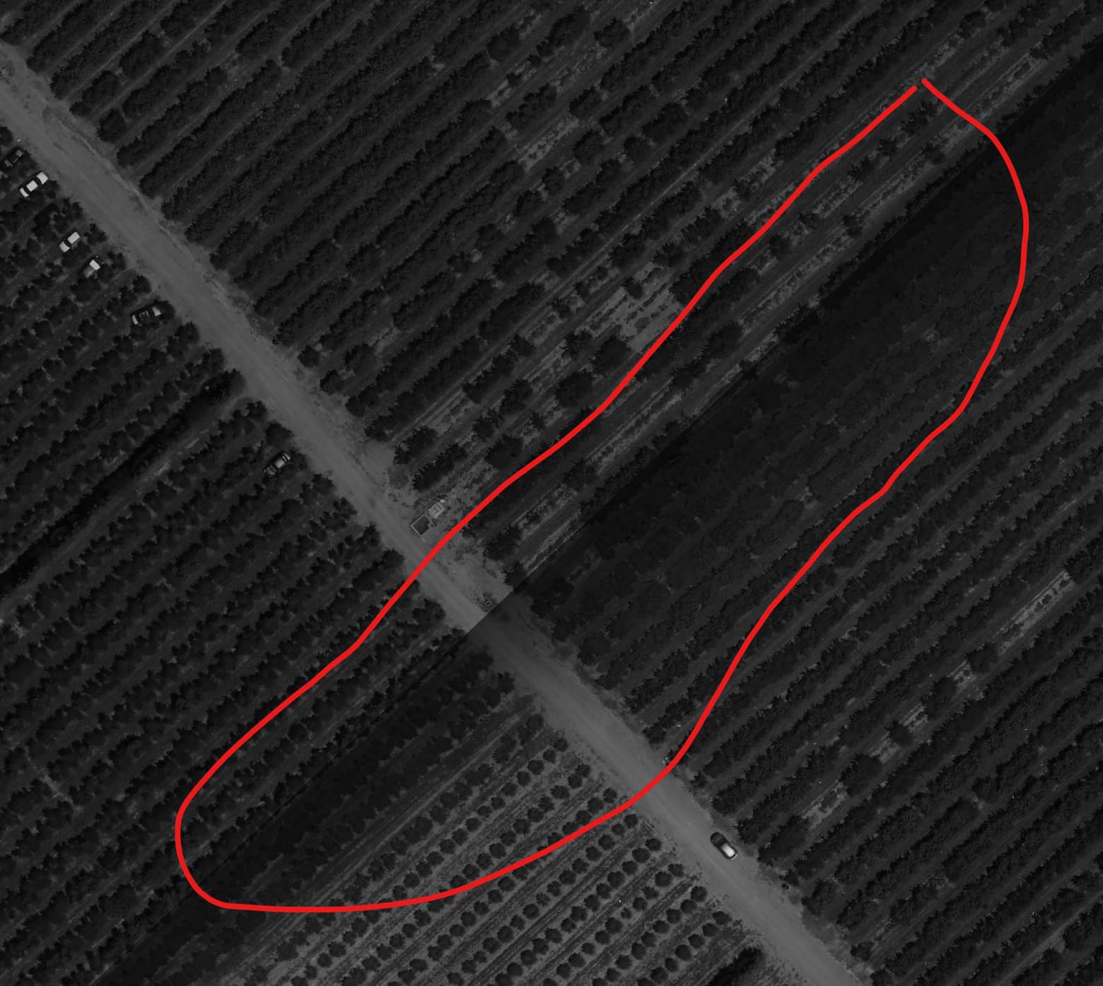
Hello, I processed 400 hectares in various areas, which were flown with a Mavic 3M. The procedures for the multispectral flights were correct, flying at solar noon and using a calibration panel for all flights.
My surprise is that Pix4D (version 4.8.4) seems to create vignetting of the orthomosaics, right at the edges where a clipping box was applied. This throws the reflectivity values off the charts.
I’m going to test processing without the clipping box, but I wanted to share this in case anyone has had the same problem and how to fix it.
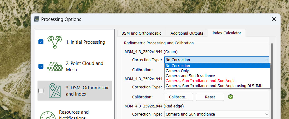
Hello there, This is happening due to the quality of the raw images. PIX4Dmapper uses the exif information to do the vignetting correction. However, if it is not able to remove it completely then you need to redo the flight or use the data that you have.
Hello @joan, If you are seeing it on the reflectance map, it is mainly due to the presence of it on the raw images or wrong values on the metadata, so try using either Camera Only correction or No correction under Radiometric Processing and Calibration.
These cookies are necessary for the website to function and cannot be switched off in our systems.
They are usually only set in response to actions made by you which amount to a request for services, such as setting your privacy preferences,
logging in, or filling in forms. These cookies do not store any personally identifiable information.
These cookies allow us to count visits and traffic sources so we can measure and improve the performance of our site.
They help us to know which pages are the most and least popular and see how visitors move around the site.
All information these cookies collect is aggregated and therefore anonymous.
If you do not allow these cookies we will not know when you have visited our site, and will not be able to monitor its performance.
These cookies may be set through our site by our advertising partner (Google).
They may be used by Google to build a profile of your interests and show you relevant adverts on other sites.
They do not directly store personal information but are based on uniquely identifying your browser and internet device.
If you do not allow these cookies, you will experience less targeted advertising.