When attempting to export an operation with all cells selected at the same rate, I get a message that “Shapefile export can not be used with this distribution of rates”. I would like to export a DJI Agras boundary missions, but that option is greyed out. When I export a VRA mission, I see both Rx and ShapeFile folders created, with a .tfw and .tif file being created in the Rx folder, but nothing in the ShapeFile folder.
I have followed the no special characters rule mentioned in a previous post, but am still having issues.
Can you share a screenshot of your mission? The DJI AGRAS boundary mission has certain limitations.
For example, this would work:
But if you have “donuts” like this, it will only work with a DJI Agras VRA mission, so make sure you have no rates inside of other rates. This is a limitation of DJI.
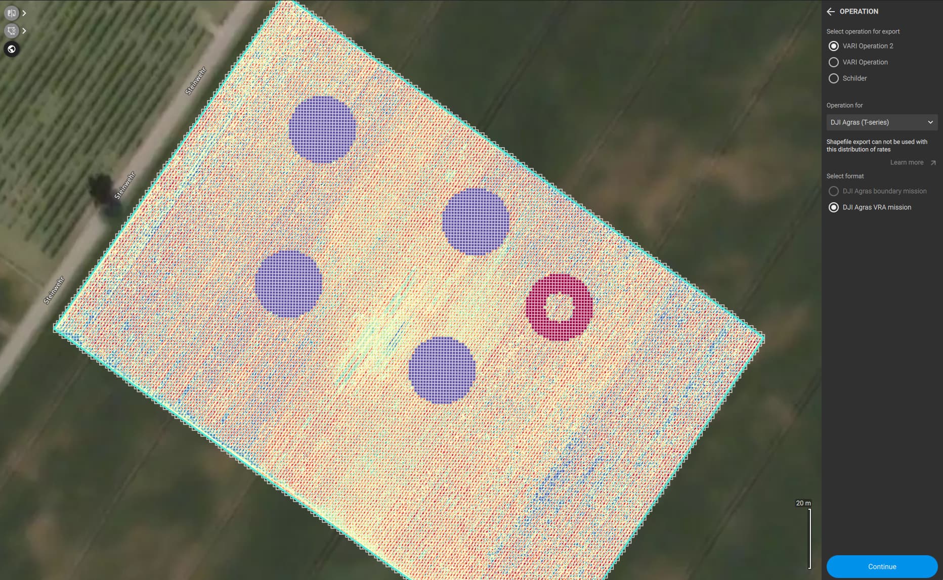
As you can see, I have created multiple sub-polygons, and I also have three “holes” as the more detailed screenshot shows.
One interesting point, when I created the operation using existing annotations, there were a handful of cells which were randomly populated to rate 1 as shown here. However, creating without pre-filling the grid did not change the ability to export a boundary file.
Hi,
that’s most likely due to the hole you have in your boundary on the north-east corner. That is not supported for boundary missions as this generates a zero rate zone, which will lead to the mentioned “donut”.
If I get rid of the hole(s) as suggested and attempt to create an operation from this ortho…
The operation still sees the random cells mentioned earlier

When I fill all empty cells with rate 1,

and attempt to export, I am still unable to generate a boundary mission and get the “Shapefile export can not be used with this distribution of rates” message

and no shapefile is exported.
Can you share the fieldboundary and obstacles or the full project with us so we can have a look?
Your boundary is very complex, did you try to create this map field by field or subfield by subfield?
Julius,
Thank you for your patience and assistance trying to help me find the issue here. This is not the first instance I have had this issue, but I am still new and trying to learn the most efficient and effective methods of using Fields. I am open to any and all suggestions you may have.
Many of the properties I spray are larger acreages, and I need to be able to break them into smaller fields. I used sub-polygons to create the multiple fields you see in this project. I prefer to do this in Fields as opposed to the DJI route segmentation option.
I am attaching the boundary/obstacle files and project files. When I export the project if exports as a p4f, but it won’t upload. Please let me know if there is anything else you need.
Thank you,
Boyd
Project Boundary-Obstacles.zip (6.8 KB)
Hi,
That area here is the problem, as it creates a hole which is not supported.
When deleting that part you can see the export works:
Is there a reason why you dont want to use the DJI VRA file ?
I tried, and could have used the VRA option if it had worked, but there was still no shapefile exported. Is there a reason to choose VRA over Boundary if the entire project will receive the same rate?
Hi,
Boundary format is much less robust and it does not support holes as mentioned above.
Despite doing fixed rate, you might find that most cases are supported by VRA.
jose