Hi, i am using pix4Dmapper to stitch multispectral (R,G,B,RE,NIR) images of a field. I am using the radiometric calibration feature and I want to produce seperate stitched and radiometric corrected .tif files using the index calculator for each seperate band.
The problem
The result contains shaded stripes as can be seen the image below
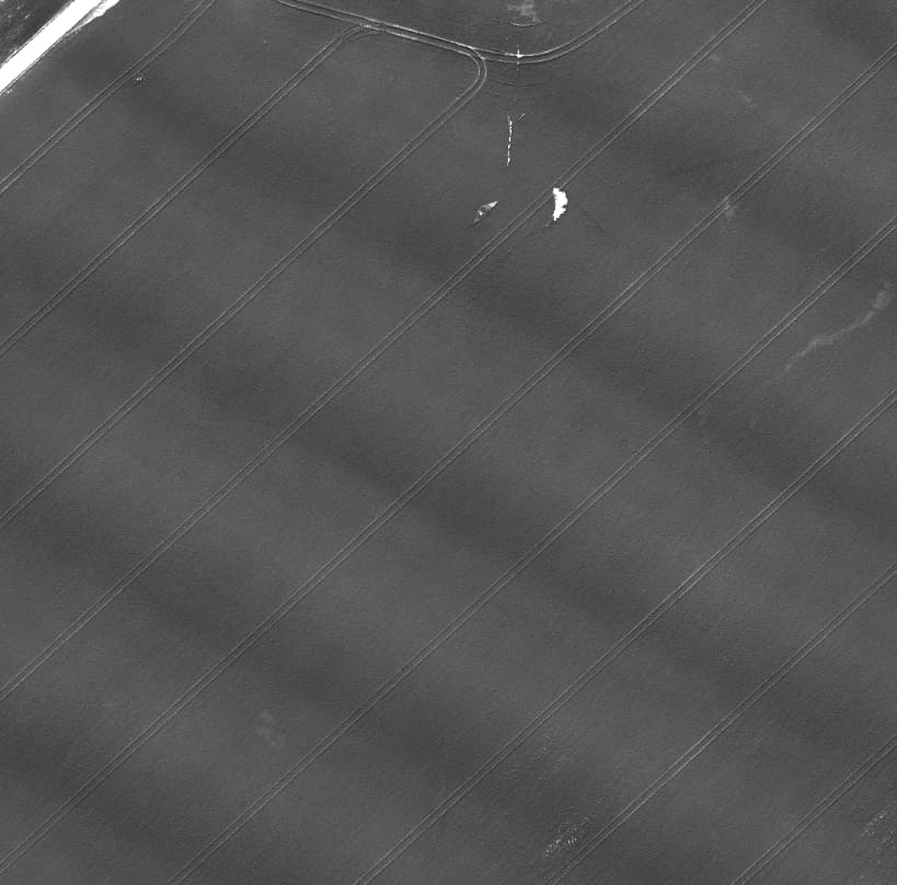
cut of red band index output from pix4Dmapper
Thoughts/Questions
I am quite new to working with drone footage and im wondering if the problem is that I am missing some setting/feature in pix4Dmapper or if the flight/capture settings (see below) is causing the stripes and how I can get rid of them.
Flight details
Drone and camera used: DJI Phantom 4 Multispectral
Front overlap: 80%
Side overlap: 65%
Radiometric calibration target used
MAPIR Camera Reflectance Calibration Ground Target Package (V2)
using the white reflectance target for this example