HI!
Pls, help solve the problem with a attitude in a models.
We need to calculate differense of the sugarbeet piles, storaging on the field.
We make a geozone above the pile & upload a photos to the Pix4DCloud
So we see big difference between the same pile from one day to another.
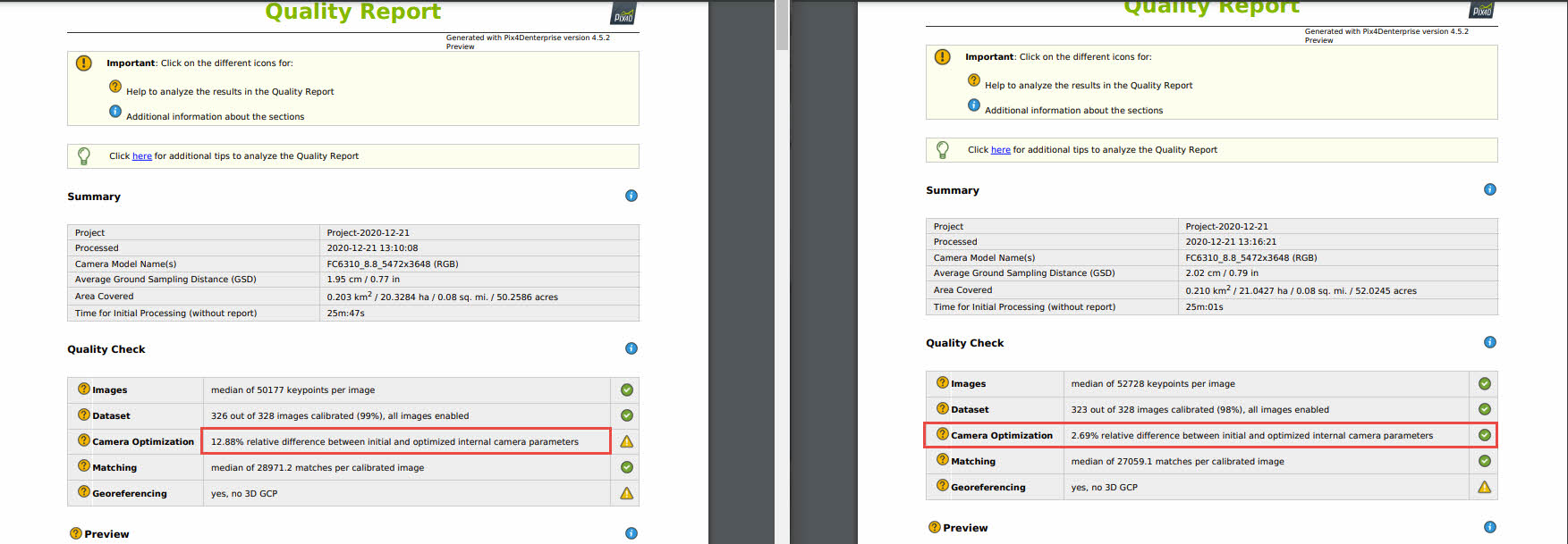
We think that a problem with heights.
When building models, there is no uniformity of heights in all projects when processing data:
- when creating a planned-high-altitude control point, there is a binding only to those photographs on which this point is indicated.
The rest of the model is displaced in the plane.
Due to this error, it is not possible to compare pile by day in PIX4DCloud in automatic mode.
PIX4DCloud gives the difference on a constant embankment on different days of about 31,000 m³
Example:
30.10.2020
02.11.2020
Same problem we get when calculate models in Pix4DMapper & upload it to Cloud
Automation of difference of volumse - it was a key function for us.
Pls help us