Good Morning,
First off, I’ve played with Pix4d Survey a few times over the last few years and never saw much to pull me in, but it’s come a long ways since the last time I used it! I’m using it to digitize an industrial mining site from photogrammetry & lidar datasets and it’s been a joy to work in the last couple of days.
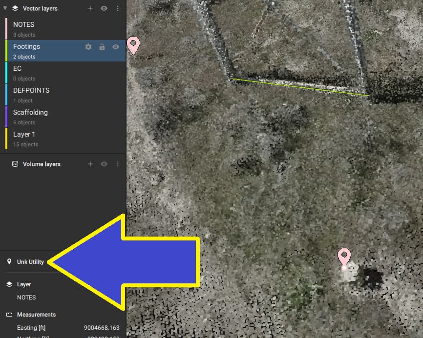
I have a script set up in Global Mapper that converts points, lines & areas to coded points (for Carlson Field 2 Finish), for our typical survey workflows. The layer options in Pix4d Survey make it pretty easy to prepare all the digitized features for this process, but we normally have a catch-all point layer for “Misc Map Notes” that include comments/observations from digitizing. I’ve been adding markers to a “NOTES” layer in Pix4d Survey, and adding my comment as the marker name. As far as I can tell though, this feature name isn’t included in the export ( tried geojson, SHP and DXF). Is there any way to transfer comments like this over to the rest of my workflow, other than just making every marker on it’s own layer? Thanks.
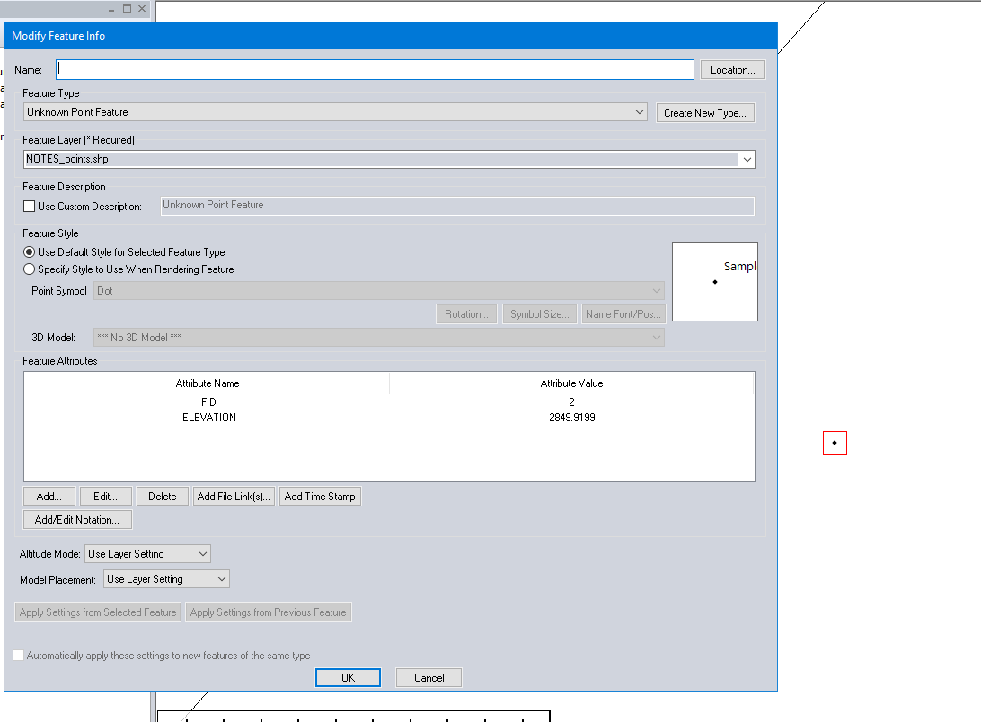
It’d be nice if the marker’s “Unk Utility” was transferred over as the feature’s name at least. Even better if it was stored as a static attribute…or if Pix4d Survey supported feature attributes in general.
Thank you for reaching out to Pix4D technical support and for sharing your detailed feedback.
Your feedback is greatly appreciated; thank you.
I passed it on to our PIX4Dsurvey product team. Even though we cannot guarantee that a solution will be implemented, I can assure you that every piece of feedback is internally evaluated at Pix4D.
I also moved your request to the feature request page of the community, so that other users can “vote” for this request. Don’t forget to vote for your request at the top-left corner of the thread.
Make sure that you check the “Column headers in the first row of the file (points/WKT only)” option on the right. That’s what will bring up the description column header that you see in the file preview window.
Choose your coordinate system, then right click on the layer in your control center and select options:
Ah Ha! Thanks Chris! I tried a CSV export before, but I completely missed that Column format options drop-down before. That did the trick, thanks!
Having this column available in a geojson export would still be greatly appreciated so that I can incorporate this into scripts easier (without dealing with defining the projection), but this helps a lot right now. Thanks again.
These cookies are necessary for the website to function and cannot be switched off in our systems.
They are usually only set in response to actions made by you which amount to a request for services, such as setting your privacy preferences,
logging in, or filling in forms. These cookies do not store any personally identifiable information.
These cookies allow us to count visits and traffic sources so we can measure and improve the performance of our site.
They help us to know which pages are the most and least popular and see how visitors move around the site.
All information these cookies collect is aggregated and therefore anonymous.
If you do not allow these cookies we will not know when you have visited our site, and will not be able to monitor its performance.
These cookies may be set through our site by our advertising partner (Google).
They may be used by Google to build a profile of your interests and show you relevant adverts on other sites.
They do not directly store personal information but are based on uniquely identifying your browser and internet device.
If you do not allow these cookies, you will experience less targeted advertising.