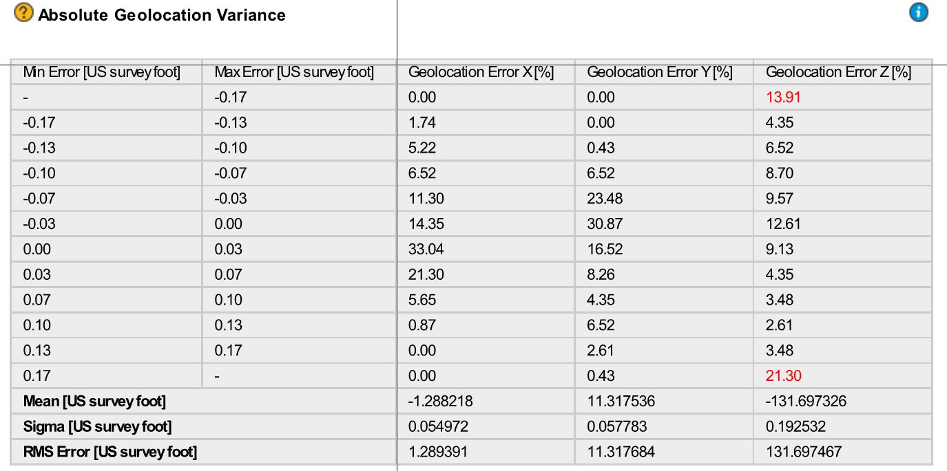
I just ran Step 1 and Step 2 on my drone flight. I’m concerned about the Absolute Geolocation Variance report. I attached a copy of the report.
- What are the acceptable parameters I should see?
- How do I fix the issue?
I just ran Step 1 and Step 2 on my drone flight. I’m concerned about the Absolute Geolocation Variance report. I attached a copy of the report.
Hi, Are you using GCPs? The high vertical RMS error for absolute geolocation variance is expected if you have GCPs as it reflects the difference between the initial vertical coordinates (wrongly measured by the drone GPS) and the computed vertical coordinates (accurate corrected with GCPs).
Yes I am using GCP’s. I typically try to use at least 7-10 GCP’s for each flight. I measure each GCP using a GNSS base and rover to gather the coordinates. I am flying the sites with a Phantom 4 RTK drone with an RTK Base station. I am concerned that my verticals are not accurate. What is an acceptable lever of error. I have run many projects with varying levels percentages of error. I just recently processed a flight and I am not sure the point cloud is accurate at all.
What am I doing wrong? Is the something in how I setup to fly?