After processing a 140 acre mall and parking lot, I compared my results to a 2019 federal LiDAR dataset. When running cross sections, shallow Xs are formed where my data crosses above then below the LiDAR. I could live with a uniform offset, but above and below does not make sense. I have 14 control points, 4 GCPs to process and 11 checks. RMS error is right at the 2x GSD, and the check points are all labeled as accurate, but the errors in check points are in the 1 to 3 foot range, much higher than I’m used to seeing. GCP errors in XY are between 1 and 6 inches, Z is very tight.
P4 Pro with Map Pilot Pro, I know about the camera selection issue and I follow the workaround.
There’s something funky going on with your checkpoints and gcps. How were they obtained?
I’m not an expert on imperial systems but I would say that 1,54 feet in z-error is quite a lot…
Hello @Jaakko_Laihola, I believe the issue might be due to the number and the distribution of GCPs. First of all, make sure that the GCPs number and the distribution is suitable to properly georeference the project, and then add an extra check point to verify the accuracy. The GCPs distribution of the last quality report looks better. I would have GCPs as shown belo for the project.
I can also see that the GCPs marking for the below point are not good. I recommend to remark them. While marking GCPs, make sure that you are only marking the one that are clearly visible, zoom to the maximum extend and mark them, mark 8-12 good images.
Unfortunately, there is a shopping mall in the center of the site, so GCPs can only be established on the periphery.
The GCPs show up nicely on the images, so picking the PK nail really isn’t an issue.
I’m wondering find the large structure in the middle of the pointcloud is creating an issue.
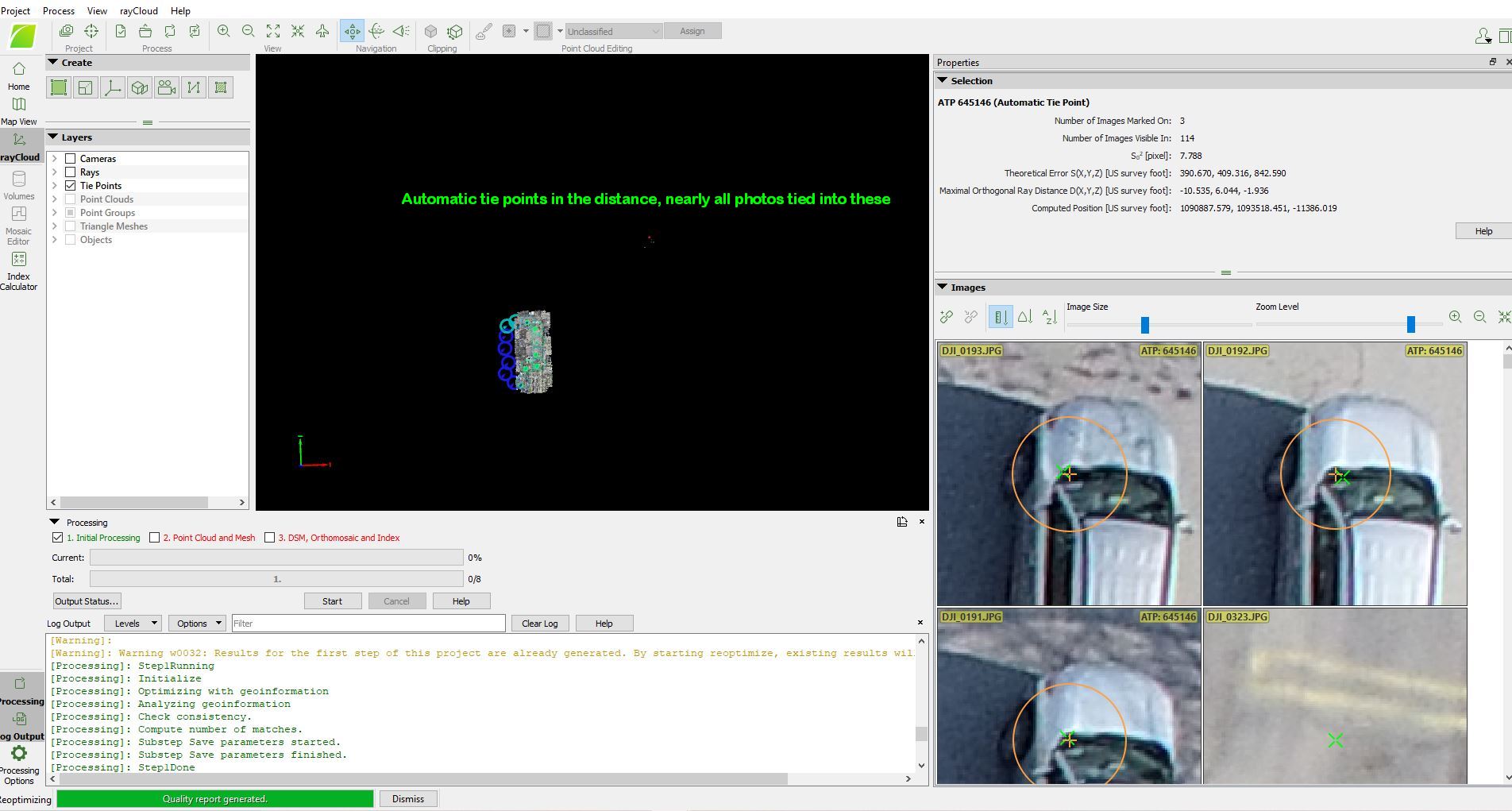
I’m also seeing automatic tie points in the distance, with nearly every photo hitting that point. Not sure if sun glare was the cause or not, just seems odd these 3 points are there. I’ve attached a screenshot showing these points.
Looking at the pointcloud, the photos on the edge appear warped, but maybe that’s the poor solution.
These cookies are necessary for the website to function and cannot be switched off in our systems.
They are usually only set in response to actions made by you which amount to a request for services, such as setting your privacy preferences,
logging in, or filling in forms. These cookies do not store any personally identifiable information.
These cookies allow us to count visits and traffic sources so we can measure and improve the performance of our site.
They help us to know which pages are the most and least popular and see how visitors move around the site.
All information these cookies collect is aggregated and therefore anonymous.
If you do not allow these cookies we will not know when you have visited our site, and will not be able to monitor its performance.
These cookies may be set through our site by our advertising partner (Google).
They may be used by Google to build a profile of your interests and show you relevant adverts on other sites.
They do not directly store personal information but are based on uniquely identifying your browser and internet device.
If you do not allow these cookies, you will experience less targeted advertising.