
All of you submitted such beautiful photos. I decided to go a different route. This photo of a landfill is titled Waste. It highlights the enormous amount of waste that humans generate and underscores the need for recycling.
14 Likes

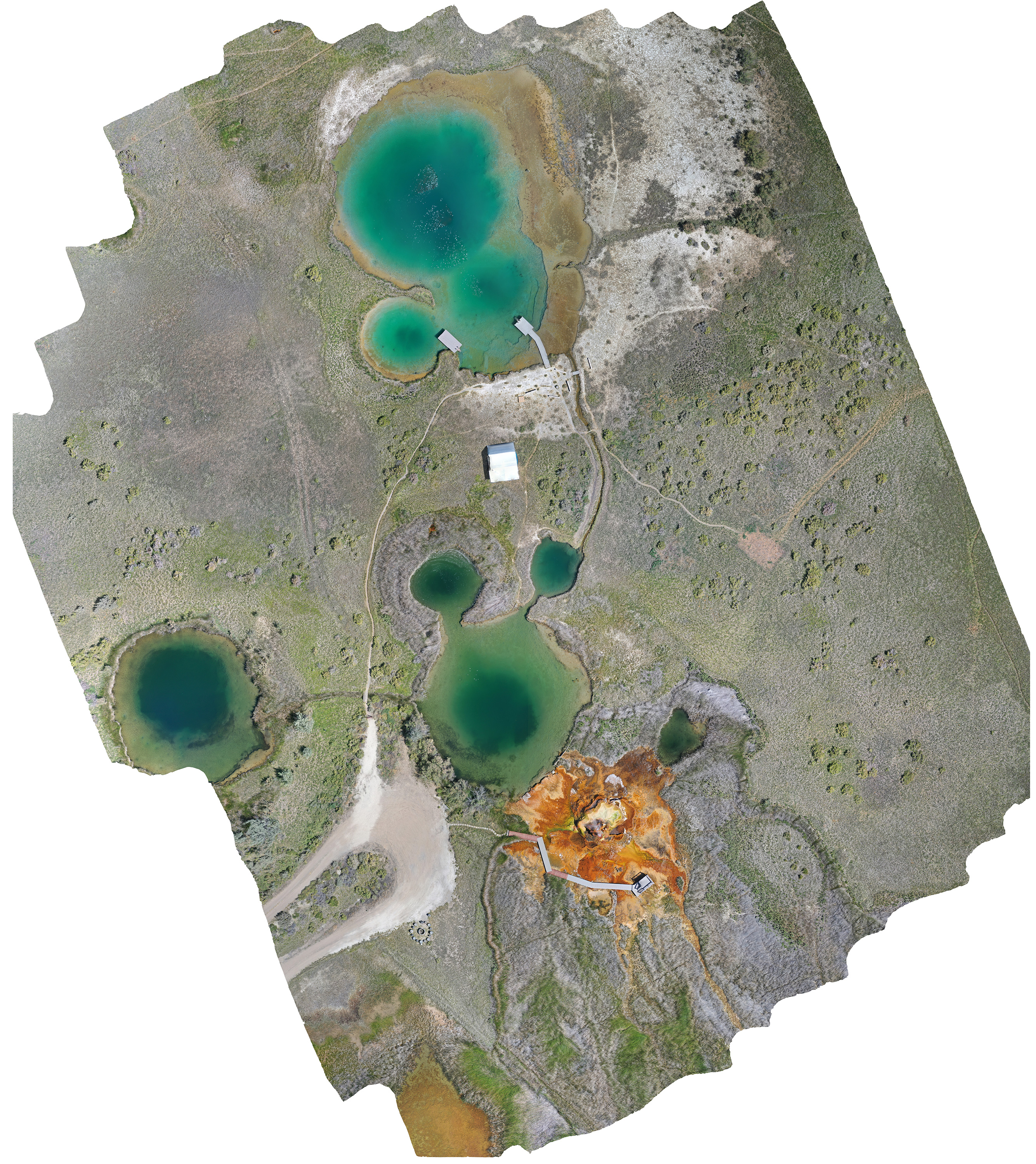
Macuaca Cove at Tayrona National Natural Park, our scientific interest about the sedimentary terraces take us to this beautiful area unknown for many tourist that visit the protected area. Images taken with a DJI Phantom 4 Pro in manual mode, credits to @costerocolombia and @invemarcolombia.
3 Likes
Binghamton University, New York, USA, Environmental Visualization ENVI 306 class photo. Training the next generation of sUAS pilots & having fun too!

3 Likes

Dear Teodora,
I will share the data sets through google drive.
Kind regards,
Hello again,
Let’s stay in touch by email.
Sincerely,
Teodora

5 Likes

This is a mapping we did in the Lofoten archipelago, Norway, the towns name is Henningsvær. Original image size is 41670x24177 pixels. You can also see the famous football field. Please credit us as Romvesen AS, @romvesen.as on Instagram.
5 Likes

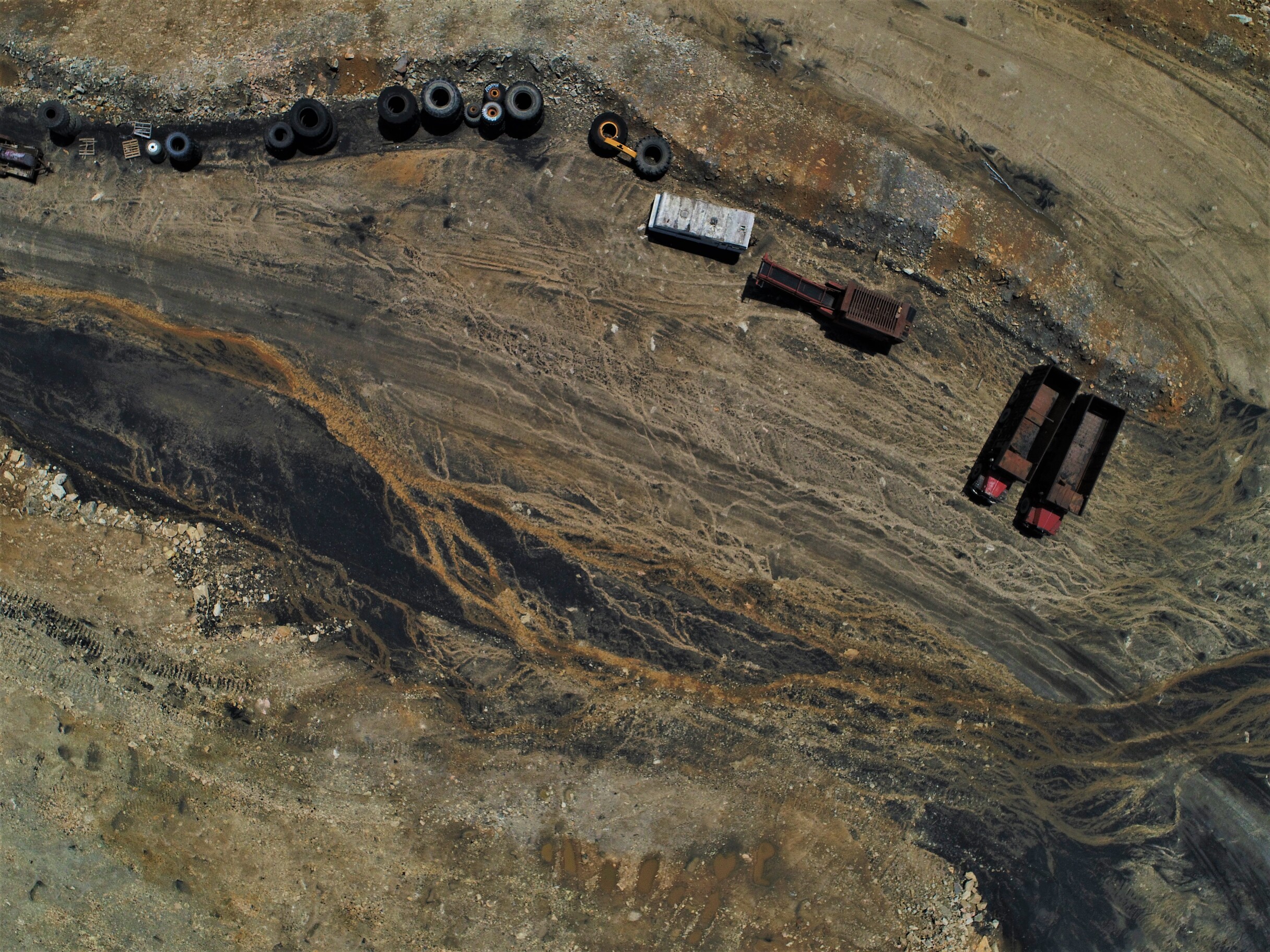
This shot was taken while mapping a coal mining site in Wise County, Virginia. This picture offers a combination of colors from coal, dirt, gravel, and minerals all intertwined from tiny channels of water. The scenery is complimented with two coal trucks idling with other equipment.
Please credit @virginiaaerobots
2 Likes

A photo of the flood in Turkey
Road destroyed and a shepherd dog was waiting for its sheep on the opposite shore.
This photo was taken with Phantom 3 Pro.
6 Likes

In 2018, the Aegean colorful coast in Turkey.
The white dots in the pond are flamingos.
This photo was taken with Sensefly eBee.
7 Likes

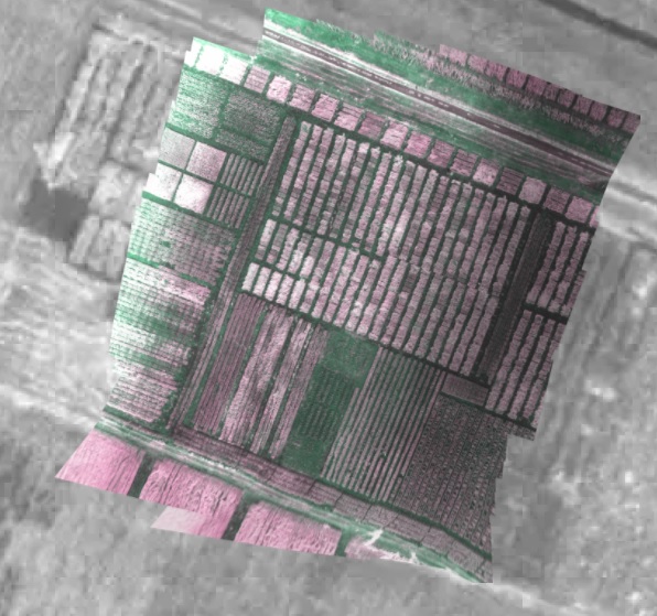
The picture is 3D model of Istanbul Technical University produced with Pix4D.
This campus project is called itu3bee.
1 Like
Please credit me as @ssemihakay and @itu3bee if you post this on instagram


Moran Surveying Inc. I took this shot as part of a larger survey for a shell fish farm on the east coast of MA, USA. We used a Sony a7rIII mounted on a Ronin MX gimbal flown on a M600 pro, at an altitude of approximately 390’ AGL on a sunny day with a 28mm lens. I used the manual mode with a shutter speed of 1/800< ISO auto f/6.3. Steve Moran PLS, www.moransurveying.com, sfmoran@moransurveying.com

5 Likes
