I just processed my first large dataset (15 ha) taken with a Mavic 2 Enterprise Advanced and RTK.
Around 1200 images, some needed to be calibrated manually due to complex structures.
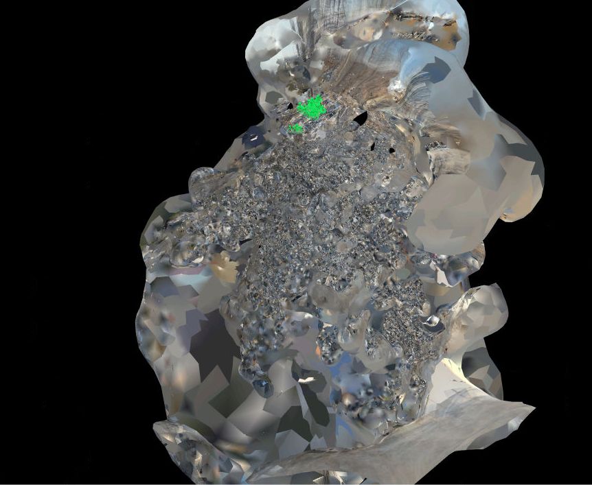
The point cloud comes out incredibly well in most areas but the mesh seems to be simply broken.
thanks for the quick reply, sorry for my delay.
Here is the report. Needed to remove a bit of information. Pix4D_Report_upload.pdf (1.9 MB)
I tried online processing in Pix4D Cloud also and it came out even worse.
Interestingly DroneDeploy seems totally fine with the data as the customer used our images in his installation and it looks perfect. I really expected more from Pix4D here.
Hi InspecDrone,
Thanks for attaching your quality report. It appears you have some high camera optimization errors. I would suggest enabling All Prior under step 1 processing options. This will force Mapper to trust your camera more than it otherwise would. I would also suggest using Accurate Geolocation and Orientation since you are using an RTK. Mapper will place more weight on the locations.
I also suggest looking close at your MTPs. Most of your points have a pixel errors well above 1. I would suggest marking these at a higher resolution so that the error drops below 1. If you cannot get the error below 1 then I would not use that MTP.
Thanks a lot for the hints! I’ll play with this and hope the results are improving.
Regarding the MTPs I am hoping for better results from step 1 so I do not have to manually calibrate so many cameras.
These cookies are necessary for the website to function and cannot be switched off in our systems.
They are usually only set in response to actions made by you which amount to a request for services, such as setting your privacy preferences,
logging in, or filling in forms. These cookies do not store any personally identifiable information.
These cookies allow us to count visits and traffic sources so we can measure and improve the performance of our site.
They help us to know which pages are the most and least popular and see how visitors move around the site.
All information these cookies collect is aggregated and therefore anonymous.
If you do not allow these cookies we will not know when you have visited our site, and will not be able to monitor its performance.
These cookies may be set through our site by our advertising partner (Google).
They may be used by Google to build a profile of your interests and show you relevant adverts on other sites.
They do not directly store personal information but are based on uniquely identifying your browser and internet device.
If you do not allow these cookies, you will experience less targeted advertising.