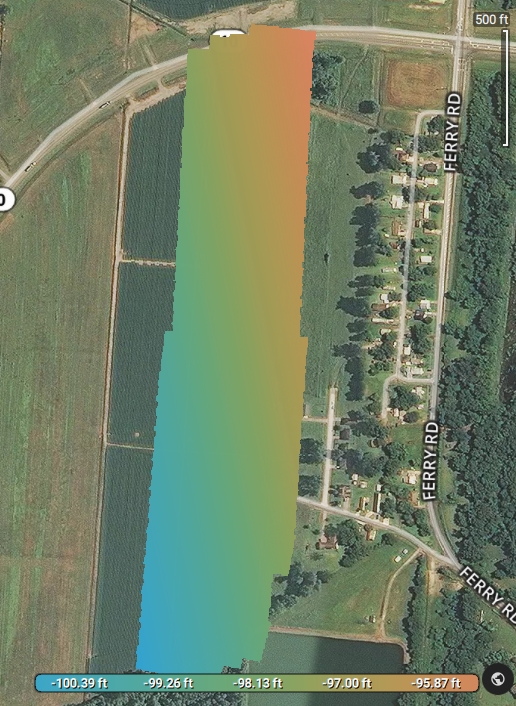
Just starting with my Trial Pix4DFields. I simply don’t understand the negative values on the sliding scale at the bottom of the image. This field is not below Sea Level. Some quick guidance on how to interpret this scale would be greatly appreciated. The mission was flown at 200ft AGL.
Hi Paul,
Have you checked if the GPS of your drone is giving you the correct values? Could you please check that for us?