Hi Pix4D Community,
I am using pix4dmapper version 4.4.12
- I first processed the drone data in Pix4DMapper for volume calculation.
Its quality report with raycloud snap.

Maruti PP ERH_report.pdf (1.9 MB)
-
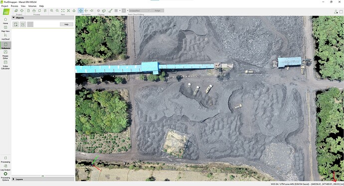
I knew the mean sea level, so I processed it in (MSL) EGM 84 Geoid in my computer. The elevation obtained in the first processing was the same elevation I got after processing (MSL) EGM 84 Geoid. The elevation did not change.
Its quality report with Ortho snap.
Maruti ERH MSL84_report.pdf (2.0 MB)
-
I again did the same process in another computer with (MSL) EGM 84 Geoid but still the elevation did not change.
-
I again did the same process in another computer with (MSL) EGM 84 Geoid but still the elevation did not change.
-
I did the same process again on a laptop and the elevation got changed. I did the same process on three computers, but the elevation did not change, but when I did the same process on the laptop, the elevation changed, despite having the same pix4dmapper and the same version. Why did this problem occur?
Its quality report and ortho snap.
MCCPL_MSL84_report.pdf (2.0 MB)
Hello @himalay.sharma, For the last project, you are using different processing option that is why you might be getting the difference. Turn on the Geometrically verified matching option or the best way would be copying the .p4d file to your laptop and double click on it to open a project with same processing option that was used on that old project.
Hi Kapil Thank you for your input.
I have another situation here
we have 2700 image of mine with GCP collected through TS (WGS 84, 44N) and after processing the data its rms error is 0.138 m which is high and not acceptable. few gcp lift by 0.6m & gcp’s are not setting up on the position.
but earlier we used the same work flow, but gcp collected through DGPS (WGS 84, 44N) only in which our rms error comes less than 10mm.
now I am not able to understand why it happening with work flow using TS and not with DGPS.
What should I do to tackle this situation.
Next step I will take gcp with both TS & DGPS and process the same data set.
Hello @himalay.sharma, The high RMS error is likely the result of poor camera optimization, inaccurate GCPs, improper marking of the GCPs, and incorrect accuracy values for the capture GCPs. So, my suggestion is to first ensure that the project is processed well, the GCPs are clearly visible, and manually mark enough GCPs(8-12).
If you are capturing the same point with TS, you can compare those values to see if the GCPs captured are inaccurate. However, you should be able to get reliable GCPs with TS.
Please attach two quality reports, one using the GCPs from TS and the other using DGPS, so that I can look into it to see if there is any issue related to the processing.


