Copter Log Services is proud to share one of our craziest surveying project ![]()
![]() . This was on „Blaue Köpfe“ in Carinthia Austria
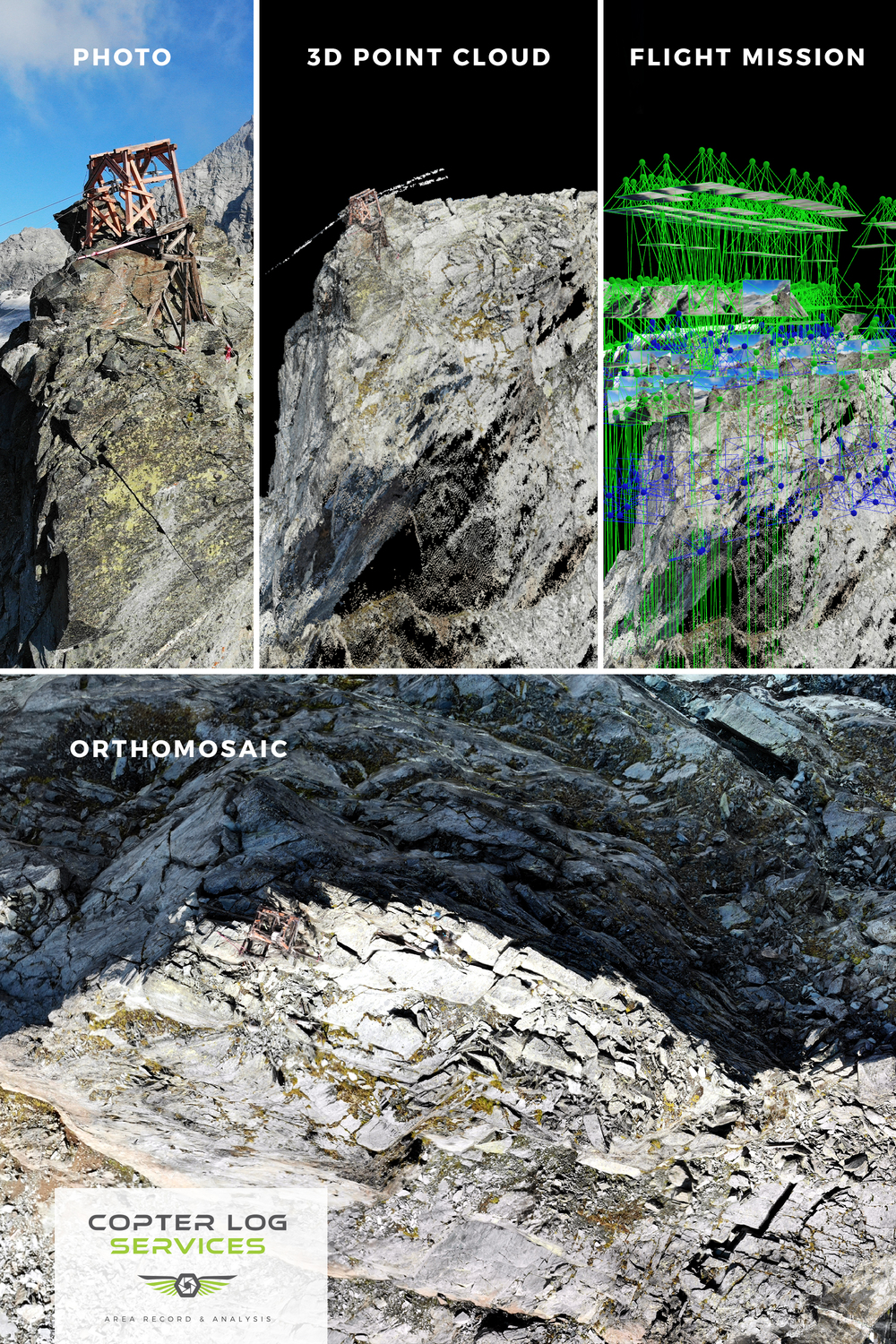
. This was on „Blaue Köpfe“ in Carinthia Austria ![]() over 3100 m above see level, next to the highest mountain in Austria (3798m ASL)
over 3100 m above see level, next to the highest mountain in Austria (3798m ASL) ![]() . Technically it was a huge challenge due the mobility factor (we had only 2-3m² to move) and the time constraint because of the weather condition (we had only 40 minutes)
. Technically it was a huge challenge due the mobility factor (we had only 2-3m² to move) and the time constraint because of the weather condition (we had only 40 minutes) ![]() . We took 3 drones with us in case one of them could fall down and this was our last chance for that year otherwise we had to wait 10 months to make the shots without snow
. We took 3 drones with us in case one of them could fall down and this was our last chance for that year otherwise we had to wait 10 months to make the shots without snow ![]()
![]() .
.
![]() Facts: Modified Mavic Air, hybrid flying mission NADIR and Orbit, Number of photos 619
Facts: Modified Mavic Air, hybrid flying mission NADIR and Orbit, Number of photos 619
![]() Time to get to the top by feet 7:30 hr. but we took the short variant with the material ropeway, 10 minutes
Time to get to the top by feet 7:30 hr. but we took the short variant with the material ropeway, 10 minutes ![]() .
.
Credit at: @copterlogservices on instagram and Redirecting...
Kind regards from Austria (we don’t have kangaroos ![]()
![]() ), all the best and happy new year 2020
), all the best and happy new year 2020 ![]()
![]() , your Copter Log Services team (www.copterlogservices.com)
, your Copter Log Services team (www.copterlogservices.com)
If you want to take a look on our project, just click here: