Hi all,
We are facing a problem with NDVI/NDRE. We just did a mission to prepare a prescription but at this time of the season NDVI/NDRE are not always reliable. I think that one part of the problem is given by crops that are lodging, in this case the drone sees a yellowish color instead of a dark green so it perceives those parts of the field as low NDVI/NDRE. But in this case in those parts the crop is too big, so the NDVI/NDRE should be the opposite. The other part of the problem is that with the crop at its peak of hight the NDVI/NDRE is not always able to perceive the differences in the different parts of the field.
Do you have any experience with this problem? Which index do you think could perform better in these conditions?
I already tried with NDVI, NDrRE and GNDVI.
Thanks a lot
Best
Filippo
Hi Filippo,
Interesting case you are mentioning. Unfortunately, there is no specific index that we know about that will be of help with lodgging. When index gets saturated (peak of height/biomass) we normally recommend NDRE or EVI, you can read NDVI Sensor: How to correct for limitations in high LAI conditions.
What is the use case of this? In our next release, we will add a feature to be able to manually select zones on a grid and adjust prescriptions made with indices, which could be your case.
Best,
José
With our next release, you can use the MagicTool to select the lodged areas and use that for your prescription map in our new Tragted Operations workflow.
Hello Jose and Julius,
Thanks for your answers.
Isn’t the EVI more indicated with satellite images? With drones what I should use as factors to correct the atmospheric parameters?
The use case is that we are trying to do a fertilization prescription map, before preparing the map we usually do some scouting on the field and we noticed that with high LAI and Lodging crops the areas given by NDVI/NDRE are not correct, so we are looking for other indexes that can help in this situation.
Thanks again
Filippo
Usually, NDRE should perform well even with late-stage crops, except your lodged crop where no vegetation index can really help you.
Is your problem that your fields looks “to” homogeneous (aside from the lodged areas) on the ndre / ndvi indices? Maybe you can share a screenshot here?
Hello Julius
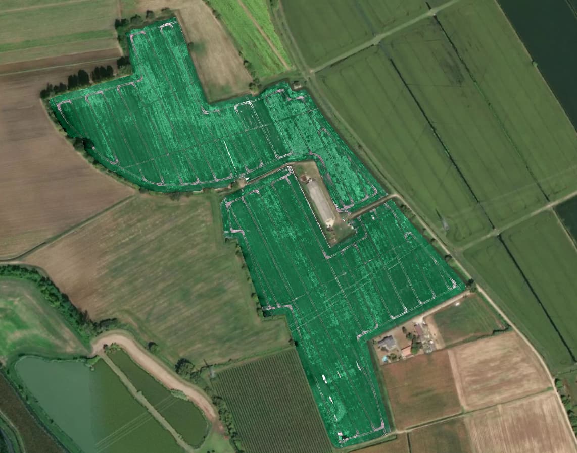
Here you can see the field with in light green the lodged areas.

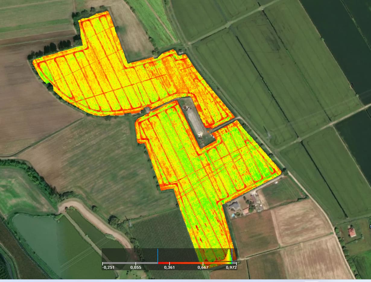
While here you can see the NDVI and NDRE. My problem is that the lodged areas in the indexes are the red ones, but they should be the green ones.
In this way the index is wrong in the whole field because the colors are mixed up.
If you need further details please let me know.
Best regards
Filippo
What you describe is logical to me. The lodged areas are probably the areas with the most vigorous crops because they were so big.
No Vegetation index will be able to help you here, and your options in the current version of PIX4Dfields 2.3 are limited to tackle this challenge. You could try to find a satellite image with the “Satellite data import”, before the lodging started and use that as the basis for your prescription map.
In our next release PIX4Dfields: Targeted Operations, you can manually draw your prescriptions and use the MagicTool to find all lodged areas. But this release will not come in time for your application anymore, I am afraid.
Thanks for your tips.
So we are looking forward to try Targeted Operations.
Best regards
Filippo